Panchayat formation
The first governing body came into existence in 1953. The first president of the Grama Panchayat was Shri. Ramaru Ramaru Potti of the Plasthanatthu Madom. The name of the Panchayat was “Kalanjoor”.
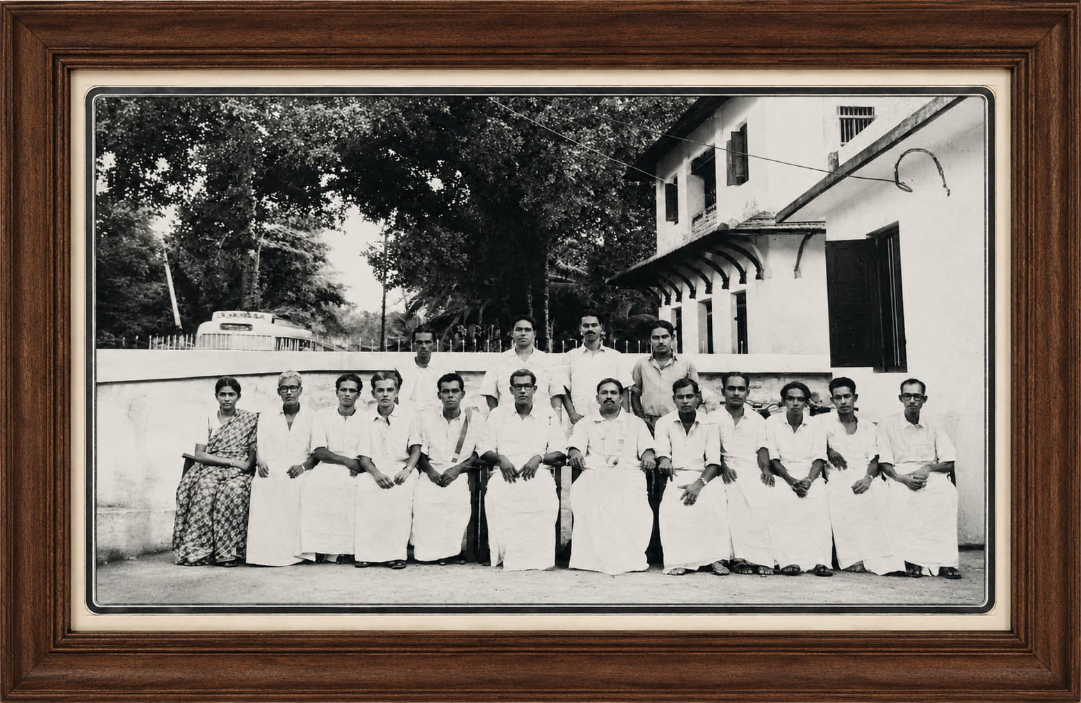
1953 ലെ ഭരണസമിതി
Ancient History
It is said that this place called Kalanjoor is the place where those who fled their village and land due to a great epidemic returned and settled. It is said that Kalanjoor is the village of arts. This village and the forest were submerged by the flood, and all the places inhabited by humans, except for the temple and the pond that existed at that time, were under water for a long time. Those who fled this area due to severe illness and suffering returned after a long time. I don't know how much logic there is in saying that the place chosen by those who came from the south as a stopover later became Etathara, and the place where those who came from the north lived in groups became today's Kud, and evolved over time. Later, the temple was relocated from Ambalathumkala, which was the first settlement and temple site (where the pond and pond can still be seen - today's Vettuvila Chira), to the present temple site, which is relatively high and in the center of Kalanjoor, due to fears of flooding like during the Great Pandemic.About 1100 years ago, the great Shiva yogi Haramaharshi (also referred to as Kharamaharshi) reached this area during his forest wanderings and meditated near the peaceful, beautiful and sacred Indilayappan temple.Subsequently, three Shiva Lingas were installed at three places, six miles apart, namely Kalanjoor, Arukalikkal and Peringanad. The prevailing place-name legend is that this village was then known as Haranur and later evolved into Kalanjoor.
The history of ancient administration
(1115-1116) He retained all the lands to the north-east of Venad, including the foothills of the Sahyadris, under Veerakeralvarma (Kotakeralvarma), who established garrisons in the highlands and isolated hilltops, settled the Kadar, Urali and Bivaru tribes, thereby preventing the nearby Pandyan kingdoms (predecessors of the Pandyan king) from taking over the spice crops from this region. But the invasion of the Tamil king Pandiyan could not be stopped. Later, the region was ruled by the Pandalam royal family, descendants of the Pandyan dynasty. During the period of the princely rule, all the territories including the areas which today extend from Achankovil to the north and west were divided and consequently came under the control of the Achankovil royal family and their own family, the Pandalam royal family, as well as the Travancore royal family and the Kodumon Arakkalikkal royal family. Again, it became a battleground during the efforts of many powerful powers to take over these areas, which were the cradle of prosperity, forest wealth and human labor. There are many historical and valuable collections here, which have been destroyed or destroyed over time. The ruins of the Parakkulam temple complex can also be seen here.
The cultural history
About eight kilometres north-east of the present Padam junction, the remains of the ancient and pre-royal tombs, the fountainless tank with a circumference of about fifty square feet, the wide corridor, the dilapidated enclosure and the crumbling Krishna stone carvings that evoke the magic of Tanjore art, can be seen even today as a relic of a glorious period of annihilation. From the east were found pottery, coins, long stone boxes in which the corpses of warriors were buried, some valuable sculptures, and inscriptions written in some vernacular language. According to historians, it has a history of 1300 years. Later, these areas were again converted into forest land and later into government land. The country is blessed with famous rocks and rare rocks. But any observer will know that tons of rocks, which were used in the construction of many temples, including the present Shri Mahadev Temple, were not collected from this area. The earliest place of worship of the Muslim Brothers is the Idathara Jama Athu Mosque (200 years old) in the south of Kalanjoor, followed by the Padam Jama Athu Mosque, built in 1945 on an area of 50 cents in the Padam area of the eastern region of Kalanjoor.
Panchayt....
Kalanjoor Grama Panchayat is located in the south - eastern part of Pathanamthitta district in the valley of Sahya mountain. It is bounded on the east by Sahyadri and Vana, on the south by Pathanapuram Grama Panchayat, on the west by Koduman Grama Panchayat, on the north by Aruvappulam Grama Panchayat and on the southeast by Piravanthur Grama Panchayat. 66 K. K. Kalanjoor grama panchayat is administratively divided into 20 wards with a total population of 40917. K. It is 489 meters. The population of the panchayat is 20779 females and 20139 males. The overall literacy rate is 92.38 per cent.
Major Places of Kalanjoor
Kalanjoor, Koodal, Athirunkal, Murijakal, Gandhi Junction, Edathara, Prathumakutty, Nirathupara, Thattakudy, Padam, Nedumankavu, Rakshasan Para . Kudappara


